A first-magnitude spring discharges at least 100 cubic feet of water per second — about 64.6 million gallons a day — and Florida has roughly 30 of them, more than any other state or country on earth. Every spring on this site pushes water up out of the Floridan Aquifer, and the magnitude number on each spring page tells you, in one line, how much of the aquifer that particular vent is moving. This guide explains what that number means, why the water looks the way it does, and how to read the rest of the spring science we put on every page.
The Floridan Aquifer and karst, in plain terms
Florida sits on top of a thick layer of limestone laid down over millions of years as an ancient seabed. Limestone is soft rock, and slightly acidic rainwater slowly dissolves it, carving out a honeycomb of underground channels, caves, and conduits. That honeycomb, saturated with water, is the Floridan Aquifer — one of the most productive aquifers in the world, and the source of drinking water for most of the state. Where the land surface sits low enough, or where a conduit intersects the surface, aquifer water finds its way out under pressure. That opening is a spring. The whole landscape of sinkholes, caves, and springs that results from limestone dissolving is called karst topography, and north-central Florida — the Santa Fe River basin, Marion County, the Suwannee River corridor — has some of the best-developed karst in the country.
Rain falling on the ground today doesn’t show up at a spring vent today. Depending on the spring, the water you’re swimming in fell as rain anywhere from a few months to several decades ago, having traveled slowly through limestone conduits from a recharge area that can be many miles away. That lag is part of why spring flow and clarity respond to rainfall with a delay, and why a spring can stay tannic for weeks after a storm has passed.
Spring magnitude: the 1–8 scale
Hydrologists rank springs on an eight-class magnitude scale based on average discharge, with magnitude 1 being the largest:
- Magnitude 1 (first-magnitude): ≥100 cubic feet per second (cfs), or ≥64.6 million gallons per day
- Magnitude 2: 10–100 cfs
- Magnitude 3: 1–10 cfs
- Magnitude 4: 100–1,000 gallons per minute
- Magnitude 5–8: progressively smaller, down to a trickle measured in gallons per minute
First-magnitude springs are the headline act — the ones that form entire rivers on their own — but plenty of second- and third-magnitude springs on our site (Ginnie, Peacock, Troy) are gorgeous, swimmable, and just as worth the drive — Gilchrist Blue normally belongs on that list too, but its water is closed for construction as of 2026, so it’s sidelined until that work wraps up. Magnitude tells you about volume, not beauty or clarity.
One more wrinkle: magnitude is an average, and flow at any individual spring varies with aquifer levels, drought, and pumping. A spring measured at first-magnitude in a wet decade can drop into second-magnitude territory during extended drought. Several springs featured on our site have documented long-term flow decline for exactly this reason (more on that below), so treat the magnitude line on any spring page as a long-term average, not a live reading — for that, check our conditions page.
Boil, vent, run, sink, rise, siphon: the vocabulary
Once you start reading about springs, you’ll run into a handful of terms that aren’t interchangeable:
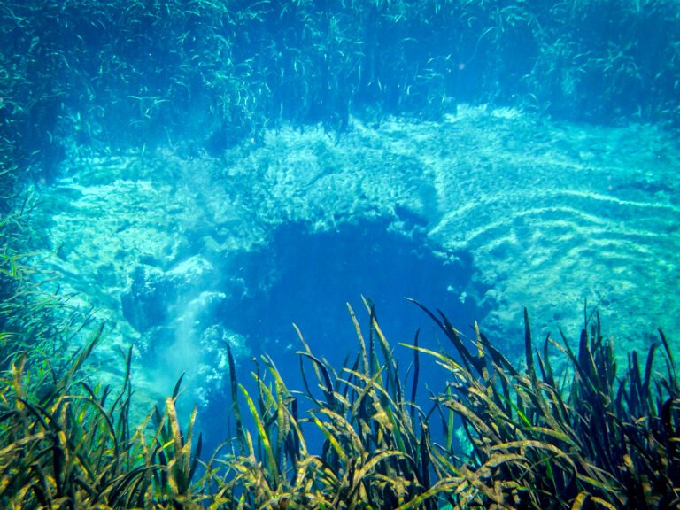
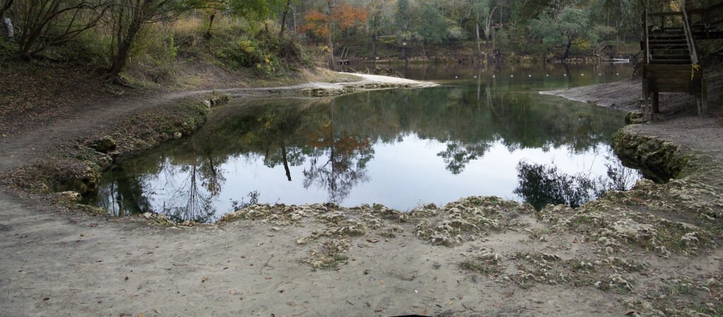
- Vent: the actual opening in the limestone where aquifer water enters the spring pool. Some springs have one main vent (Ichetucknee’s Head Spring); others have dozens of smaller vents scattered across the pool and downstream (Rainbow Springs, Gilchrist Blue).
- Boil: the visible surface disturbance where water is pushing up hard enough to roil the surface — you’ll see this clearly at Wakulla and Manatee Springs. Not every spring has a strong surface boil; low-flow springs can look nearly still.
- Spring run: the short river that carries water from the spring pool to a larger receiving river (or the Gulf). The Ichetucknee run, the Rainbow River, and the Homosassa River are all spring runs, and they’re often the best part of the visit — clear, current-driven, lined with eelgrass.
- Rise: where an underground river resurfaces after flowing through a cave system for some distance — Wakulla Spring is the classic example, part of one of the longest mapped underwater cave systems on earth.
- Sink: the opposite of a rise — a point where a surface stream disappears underground into the aquifer. Several rivers in north Florida “go underground” at a sink and reappear miles away at a rise.
- Siphon: a cave passage where water flows inward, away from open water, rather than outward — a serious hazard for untrained divers because the current pulls you deeper into the cave instead of toward the exit.
Why the water is 72°F
Spring water arrives at a nearly constant temperature because it isn’t responding to today’s weather — it’s the temperature of the aquifer rock it’s been sitting in, which reflects the region’s annual average air temperature rather than any single season. For most of north and central Florida that works out to roughly 72°F year-round, which is why springs feel shockingly cold in August and surprisingly warm on a 45°F January morning. We cover the mechanics of this in more detail in why Florida springs are 72°F year-round (and why some aren’t) — the short version is that a handful of springs run warmer or cooler because of unusual geology, and Warm Mineral Springs down in Sarasota County is the big exception, sitting around 85°F because it draws from a much deeper, geologically distinct source.
Why the water looks the way it does
The blue-green color you see in photos of Ichetucknee’s Blue Hole or Gilchrist Blue’s main boil isn’t dye or a filter — it’s a real optical effect from three things happening together: exceptional clarity (little suspended sediment to scatter light randomly), depth (a deep, clear pool absorbs the red end of the visible spectrum first, leaving blue and green light to scatter back to your eye), and a light-colored limestone bottom that reflects what’s left. The deeper and clearer the pool, the more saturated the blue. That’s why the same spring can look pale turquoise in the shallows and nearly cobalt over the vent.
Not every spring runs clear, though. Tannic springs and rivers get their tea color from tannins — organic compounds leached out of decaying leaves and swamp vegetation in the recharge basin, the same chemistry that colors steeped tea. Tannic water isn’t dirty or unsafe; it’s just naturally stained, and it usually still runs clear once you’re a foot or two below the surface near the vent. Springs fed more directly by swampy, blackwater tributaries (parts of the Suwannee system) run tannic more of the time, while springs with a more isolated, sand-and-limestone recharge area (Ginnie, Gilchrist Blue on a good day) run gin-clear more often. After heavy rain, even normally clear springs can go tannic or turbid for days to weeks as surface runoff and river backflow push into the spring run — we break down exactly how that works, and how to check before you drive, in tannic water and clarity at Florida springs.
Flow decline, nitrate, and algae: what’s actually happening
Several of Florida’s most-visited springs have measurably less flow today than they did a few decades ago, and many show elevated nitrate levels compared to historical baselines. Both trends are documented by state and district water-monitoring programs and aren’t in serious scientific dispute. Flow decline is generally attributed to a combination of increased groundwater pumping (for agriculture, utilities, and development) across the aquifer’s recharge area and periods of below-average rainfall. Nitrate increases are generally attributed to fertilizer application, septic systems, and other land uses in a spring’s contributing groundwater basin working its way into the aquifer over years to decades — remember, the water reaching a vent today often fell as rain a long time ago, so today’s nitrate levels reflect land use from years back, not just this season’s rainfall.
Elevated nitrate matters because it feeds excess algae growth, which can coat submerged grasses, reduce clarity, and change the look and feel of a spring run compared to older photos. You’ll notice this most at springs with long visitor histories and well-documented pool bottoms, where algae coverage has visibly changed over the years. We’re not going to wade into the politics of water policy here — that’s outside what this site is for — but if you want the raw numbers for a specific spring, your county’s water management district (Suwannee River, St. Johns River, or Southwest Florida, depending on where you are) publishes flow and water-quality data going back decades.
Spring-fed rivers
A spring-fed river is a river whose flow, especially in its upper reaches, comes mostly or entirely from spring discharge rather than surface runoff — which is why these rivers run clear and a constant 72°F even when everything around them is muddy and hot. The Ichetucknee, Rainbow, Weeki Wachee, Homosassa, Chassahowitzka, and Wakulla Rivers are all spring-fed, and so is the upper Santa Fe near the High Springs cluster. These rivers behave differently from rain-fed rivers: their flow is more stable through a normal season, their water temperature barely moves, and their clarity depends more on what’s happening at the headspring than on local rainfall — though a big enough storm can still push tannic water in from downstream tributaries.
How to read the magnitude line on our spring pages
On each spring page we list the magnitude class alongside average discharge where it’s documented. Read it as a long-term average discharge class, not a guarantee of current flow or clarity — pair it with our conditions page for anything close to real-time, and with the spring’s own page for notes on typical clarity patterns. A first-magnitude spring can still run low in a drought year, and a smaller spring can run strong and clear right after the aquifer’s been recharged by a wet summer.
First-magnitude springs on our site
Based on published discharge data, these springs featured on Florida Springs Finder are classed as first-magnitude (or have been in periods of normal flow): Wakulla Springs, Silver Springs, Rainbow Springs, the Ichetucknee spring group (Head Spring plus its tributary springs, combined), Alexander Springs, Silver Glen Springs, Blue Spring State Park (Volusia County), Manatee Springs, Fanning Springs (historically first-magnitude, though its flow fluctuates enough that it sometimes measures in the high second-magnitude range), Troy Spring, Madison Blue Spring, Weeki Wachee Springs, Homosassa Springs, Chassahowitzka Springs, and Jackson Blue Spring in the Panhandle. Wekiwa Springs is a well-known second-magnitude spring — strong flow, but below the first-magnitude threshold. We flag any spring’s magnitude as first-magnitude only where we’re confident in the published data; if a spring’s classification has shifted with recent monitoring, treat the individual spring page as the more current source.
Common questions
Is a bigger-magnitude spring always better to visit?
No. Magnitude measures volume, not beauty, clarity, or crowd size. Some third-magnitude springs like Ginnie or Gilchrist Blue are more visually striking and easier to enjoy up close than a massive first-magnitude spring like Wakulla, where swimming isn’t even allowed.
Why does a spring’s flow change if it’s fed by a “constant” aquifer?
The aquifer itself rises and falls with rainfall, recharge, and pumping over months to years, and spring discharge tracks aquifer levels. “Constant” describes the water’s temperature and chemistry more than its exact volume, which does vary over longer timescales.
Can I tell a spring’s magnitude just by looking at it?
Roughly, yes — a spring that’s forming a visibly large river with a strong boil is likely first- or second-magnitude, while a small, quiet pool that barely moves is probably lower magnitude. But looks can deceive; some low-flow springs are deep and dramatic-looking without moving much water.
Do all springs eventually reach the ocean?
Most spring runs on our site flow into a larger river (the Suwannee, Santa Fe, St. Johns, or Withlacoochee) or, for a few, directly toward the Gulf, and from there to the ocean. A handful of coastal springs are tidally influenced near their mouths.
Why do some springs go tannic while others nearby stay clear?
It comes down to the recharge area feeding each spring. A spring drawing mostly from a sand-and-limestone basin with little surface swamp influence tends to stay clearer, while one connected to blackwater tributaries or with a shorter, more surface-influenced flow path colors up faster after rain.
Sources / verified against: Florida Geological Survey spring classification data, Suwannee River Water Management District and St. Johns River Water Management District spring monitoring reports, and Florida State Parks and Florida Forest Service site information for individual springs.